SketchUp Make
16.1.1450 32-bit / 17.2.2SketchUp Make: An easy-to-learn 3D modeling program
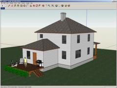
Google SketchUp is a free and intuitive 3D modeling program that will assist you into learning how to create 3D models of houses, decks, sheds, home additions, woodworking projects and pretty much anything else.Add realistic details, textures and glass to your creations, design with dimensional precision and add your completed models in Google Earth, share them by posting them to the 3D Warehouse or simply print copies.
Google SketchUp comprises a large collection of tools for drawing and modifying geometry, namely Ploygon, FollowMe, Offset and Intersect with Model and also construction tools: Dimension, Tape Measure, Protractor, Section Slice, Layers, Area & Length Calculation.
Features:
- Draw models and also modify, measure and rotate them or scale geometry.
- View and work on model interiors by placing section slices.
- Built-in and textures and components such as trees, cars, doors and windows.
- Soften and smooth faces.
- Real-time shadows based on location on Earth for an extra-realistic effect.
- Simulate movie camera placements, perform walktroughs and create presentation tours.
- Allows you to import 2D images (jpg, png, tif, tga, bmp) and 3D models (3ds, dem, ddf, dwg, dxf, skp) and export 2D images of your models as jpg, bmp, png and tif files.
- Print your 3D models or export them to Google Earth.
- Extend the program’s functionality by creating your own add-ons using the Ruby programming language.
Download Details
-
License:
Freeware
-
Platform:
Windows
- Publisher:
-
File size:
34.20 Mb
-
Updated:
May 15, 2019
-
User Rating:
4.2 / 5 (44 votes)
-
Editors' Review:
Not yet reviewed
-
Downloads:
20,444